Travel blog #4 There’s always a bit more history
- Pamela Sonier
- Jul 8, 2024
- 18 min read

Updated: Jul 12, 2024
Quiet night at the Saint Barbe ferry terminal in Newfoundland. We stayed here for the night to catch the morning ferry to Labrador. The next morning the crossing was a bit rough and poor Guy did not fare well. He was quite ill and threw up over the rail pretty much the entire 2 hour ride. On the brighter side, I did see whales in the far distance, and a small iceberg. We stopped for a couple hours outside the terminal for Guy to catch up on much needed rest.

Ferry to Blanc-Sablon

Guy and Treme after the ferry ride…..

First Puffin we see - Outside Blanc-Sablon Visitor Information Center
I know we keep saying Labrador but technically Blanc-Sablon and the Ferry terminal are in Quebec. On arrival most people turn right and continue onwards into Labrador towards L’Anse-au-Loup, Red Bay, and other historic sites. We on the other hand turned left towards the lower north shore of Quebec which is quite spectacular. Beautiful scenery everywhere. The tallest tree is probably 20 feet high and they are very far and few in between, this allows for more unobstructed views of the landscape. It’s hard to keep our eyes on the road as the scenery gets better and better at each turn in the road. Nature has created so many shades of greens, splashed all along the rocky hillsides. We spotted a few small icebergs along this stretch of road. Worth mentioning here, highway 138 is a great road with very few potholes - but still, Guy ran out of fingers counting. We drove through Blanc Sablon, Middle Bay, and St Paul’s River all the way to Old Fort where highway 138 ends, literally. The road pavement comes to an end and beyond that is the shore and then the water.

First glimpse of icebergs - Northern Shore Quebec

Highway 138

Highway 138

Highway 138

Scenery along the highway

Scenery along the highway

Scenery along the highway

End of the road - literally
The lower north shore and this entire area is steeped in history dating back almost 9000 years when the earliest Amerindian People were here. The Amerindian were the Indigenous peoples of the Americas who lived in the region long before the arrival of European settlers. There were the Paleo-Eskimos, the Thule Culture, and the Inuit. Then came the European Fishermen and Basque Whalers. As the story goes here, Jacques Cartier most likely first set foot on North America soil at Greenly Island in June of 1534. Greenly Island is located just off the shores of Blanc Sablon Quebec. He entered the harbour of Brest (Old Fort Bay) on June 10, 1534. There he celebrated the festival of St. Barnabas on June 11th 1534 (the first recorded mass in Canada). The following day it is believed he erected the first cross in honour of the King of France at Baie-des-Rochers, now known as Rocky Bay - hence claiming the land.

View from the top Old Fort, Quebec
Interesting add-on is while visiting the tourist information centre in Blanc Sablon, we read that Greenly Island is also known for The Bremen. The Bremen was a plane built in Germany in the 1920’s it had one engine and no radio. It was the first ever successful Trans-Atlantic east to west flight. If you consider an emergency crash landing into Greenly Island successful but that is exactly what happened. The Bremen left Ireland April 12, 1928 for New York. They had flown for almost 36 hours when they discovered they had veered somewhat off course. With only 2 hours of fuel remaining, they saw the light from the lighthouse on Greenly Island. As they got closer they saw people waving and thought it was Newfoundland. Captain Khôl made the decision to land the plane. The plane was quite damaged as it broke through the ice in the pond while trying to land, all crew members landed safely. Although they did not reach their intended destination of New York - they had veered off course by about 2300 kms - they did succeed in crossing the Atlantic.

Crew of the Bremen
We keep wondering how people here can possibly live so far away in such remote places. But they do and they thrive. There seems to be no lack of supplies in the area, the general stores, it seems, have everything to sell from groceries to construction supplies to clothing to liquor and much more. Our stay in the area was at a wonderful Harvest Host, Salmon Bay Farm where they farm scallops. The night, unfortunately, was another night filled with torrential rains and almost out of control wind - a bit unnerving. We parked behind a building to prevent the van from too much rocking. In the morning, total opposite, the wind and rain had stopped and the sun was shining. Pamela joined the one hour tour they offered. Included in the tour was the explanation of scallop farming from breeding to harvest; eating a raw scallop which she hand picked; also included was a cooked scallop, berry tarts and of course a nice glass of champagne and orange juice. (Even though it was 9 in the morning)

Salmon Bay Farm - stop for the night - morning after the storm

Salmon Bay Farm

Different Scallop traps

Hand picked scallop

My scallop

Breakfast
Just down the road, the Whitley Museum in St Paul’s River was another interesting stop. The first day we came they were closed. We tried again the following morning and luckily it was open. The lady working there told us they were closed the day before to celebrate a retirement party - typical to the region, I guess. The museum does explain the history of the area and the cod fishing and is named in honour of Captain William “Bossy” Whiteley who invented the Cod Fishing Trap here in the late 1860’s.

Whiteley Musuem - St Paul’s River , Quebec

Captain William Whitley - inventor of the Cod Trap
Travelling back pass Blanc Sablon into Labrador, we stopped at The Gateway to Labrador Visitor Information Centre located in L’Anse Au Clair. This building is the former St. Andrew’s church built by volunteers between 1909 - 1919 and was beautifully restored in 1992. Time change here is another mind boggling thing. As we cross the border between Quebec and Newfoundland the clocks turn 1½ hours ahead to Newfoundland time. Speaking with the lady in the visitor centre it is hard to imagine how they live so close, a mere 5 kms to the border, yet travel between provinces for school, work, visiting friends and family always needing to be changing the time. When asked about it, she simply shrugged her shoulders and with a big smile says ‘not a problem, just the life I guess’. One advantage to this time change, according to the lady, is that she celebrates New Year’s twice every year, like stepping back in time. You can take one step ahead across the border and the second foot would be lagging by 1½ hours.

Welcome!

Gateway to Labrador Visitor Center
We continued driving towards L’Anse Amour to visit the Point Amour Lighthouse and Historic Site. This lighthouse is the tallest in Atlantic Canada and the second tallest lighthouse in Canada, standing 109 feet. It was built in 1857 and began operations in 1858. This lighthouse was an important, and still is, navigational aid in the Labrador Straits. The Wyatt family were light keepers here from 1879 to 1963 for three generations. First was Grandfather Matthew Wyatt then his son Thomas Wyatt who also operated the Marconi Wireless Telegraph Station established here in1904. Wyatt was credited with aiding in saving four lives from the HMS Lily shipwreck. His son Jeff Wyatt followed suit and was the light keeper here for 44 years. Interesting fact about Jeff Wyatt is he too was a wireless telegraph operator and was the one who signalled the news to the world about the Bremen plane crash landing on Greenly Island. Jeff also aided in helping to settle the 786 crewmen from the H.M.S Raleigh shipwreck. We had a guided tour to the top of the lighthouse. It is a 132 steps to the top with lots of interesting facts about the lighthouse on the way up. It is estimated that Jeff Wyatt climbed these steps at least 10,000 times in his career. The walls of the tower are 6 feet thick with three thickness of solid interlocked granite rocks. The lighthouse was built from the inside out and all the timber used was shipped from Quebec. Eider sea ducks would occasionally crash through the ¼ inch thick glass windows. As per our tour guide, the keeper and his family would take advantage of the free meal offered to them and use the feathers for bedding. The light house beam can be seen from 34 kms away. After 138 years of continuous operation the lighthouse went automated in 1995. The four lightbulbs are now changed every four years. The winds at Point Amour can blow up to 200 km per hour and has been the location for numerous shipwrecks over the years. One of the more famous is the British Warship H.M.S Raleigh. This British warship was only 3 years old when it ran aground trying to avoid the only iceberg in the straight at the time in 1922. It was only a mile and a half from shore. Eleven crew members died trying to reach shore. As per our guide, in their embarrassment the British Navy blew up the warship in 1926 and the metal wreckage was left to rust and be forgotten along the shore. Large chunks of wreckage can be seen while Walking the Raleigh trail outside the lighthouse.

Point Amour Lighthouse

Point Amour Lighthouse

Spiral staircase inside the lighthouse

Six feet thick walls

British warship H.M.S Raleigh metal scraps after explosion

Wreckage along the beach
Located down the road from the lighthouse is the amazing L’Anse Amour Funerary Monument. In 1973 archaeologists discovered this burial mound which contained the skeleton of a child and artifacts unlike anything ever found in the area. This is the oldest elaborate gravesite in North America. It is estimated to be 7,700 years old. It amazes us that so much history was unknown for so long. People have lived here for a long time without knowing that the land they live on has been walked on by others for as far back as 9000 years.


L’Anse Amour Funerary Monument 7,700 year old grave

L’Anse Armour Funerary Monument. 7,700 year old grave
The next day, feeling a bit adventurous, we decided to challenge the Tracey Hill Trail just outside of Red Bay. This is a 1.6 km hike each direction with 689 wood constructed steps and boardwalks to the top - just over 500 feet of elevation from the first step taken. At the top we enjoyed views of the community of Red Bay, Saddle Island, Penney Island and the Strait of Belle Isle. The hike itself was not too hard as the steps were well built and also well maintained. We didn’t stay at the top very long as it was very windy, but the views at the top and along the way up were well worth every step taken. After coming down, we also did the Boney Shore Trail along the beach the locals call Boney Shore. The name comes from the whale bones left here from the Basque whalers of the 16th century.

Start of The Tracey Hill Hike

Tracey Hill Hike

More Stairs!

Tracey Hill Hike

Enjoying the views

Views from the top

Boney Shore Trail

Boney Shore Trail
Red Bay National Historic Site is the location of the Basques’ whaling site. Now this place is intriguing in many ways; one interesting point is the way it was discovered. Selma Barkham was a Canadian Historian and Geographer. On a visit to Basque Country in Spain with her husband who was told by a local Priest that he had seen local archives regarding visits to “Terra Nova” (Newfoundland) by Basque whaling expeditions dating as far back as the 1530’s. Barkham became very interested in this, as there was no information between the voyages of Jacques Cartier in 1534-1536 and Samuel de Champlain’s voyage beginning in 1604 in this area. She taught herself Spanish and went back to Spain in 1972. There she spent a few years studying archival documents and became convinced that the priest was correct. In 1977 she went to Red Bay and found proof that this area had been a major whaling site. The galleon - San Juan wreck was also discovered off the shore. On Saddle Island a cemetery was discovered with the remains of 130 whalers. The exhibits at Red Bay are intriguing including many artifacts from tools, weapons, clothing, cooking utensils and parts of the San Juan wreck many are well preserved. We stayed for a couple hours but could have spent many more hours reading about the rich history of the area.

Whale oil

Artifacts Red Bay

Artifacts Red Bay
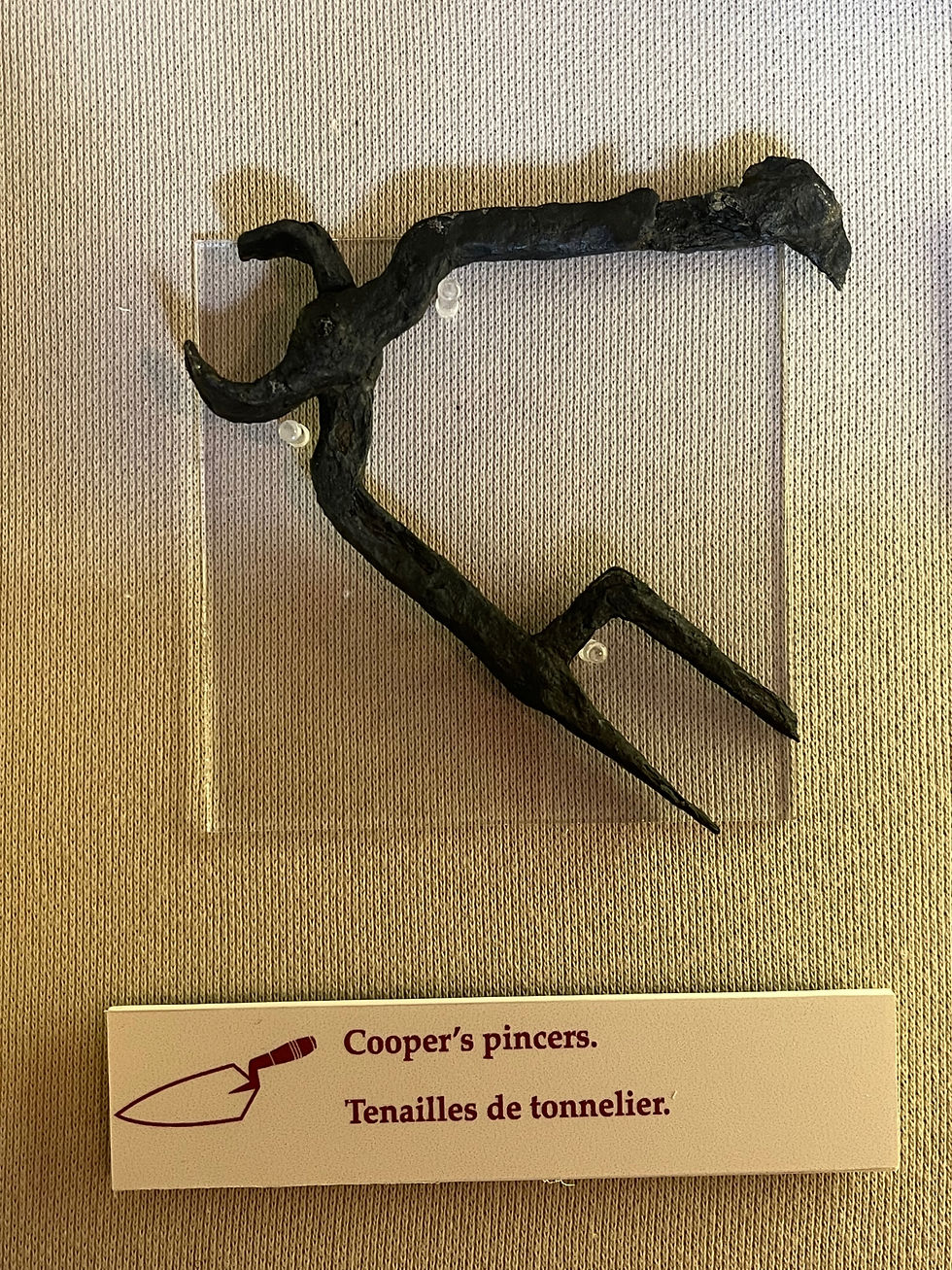
Artifacts Red Bay

Artifacts Red Bay

Replica of the gallon San Juan
Just one hundred metres down the road from the Red Bay National Historic Site is the Right Whale Exhibit Museum. This is home to the remains of an approximalty 500 year old whale. They wanted to keep this exhibit as true to itself as they could so they did not add any of the missing pieces of the whale with artificial bones or bones from other whales. The tail and fins, our guide told us, are missing because these were the first to be removed by the whalers. There are two types of whales the Bowhead (Greenland Right Whale) and the North Atlantic Right Whale. The name “Right Whale” comes from the “right” whale to hunt. The museum goes into great detail for the history and explanations of the whales. One we found very interesting was how the whales eat. The whales have hundreds of oral tissue that hang from their upper jaw. Each frayed with hairlike strands at the edges, they are interlocking and act like a sieve. The whales take food from the water and their tongues then push out the water and they are left with the remaining food. The whale bones found throughout the area have been used for many items over the years like chairs, walking sticks, and doorstops, to name a few.

500 year old Whale Skeleton

Whale Baleen Plates
Today we traveled in the rain to Mary’s Harbour where we will cross to Battle Harbour. Speaking with the staff here in Mary’s Harbour, there is no gas station in their remote village. It is hard to imagine but they must drive at least 50 kms each way just to get gas. So they make their trip worthwhile by taking as many jerry cans as they can to fill up. The same is true for most other supplies needed in this area.

Mary’s Harbour Checkin

Mary’s Harbour
One of the major highlights of our trip was the two days and two nights we booked in Battle Harbour way back in August 2023. At Mary’s Harbour we took a “ferry” (a 38 passenger boat) for the crossing. Both Guy, who did not get sick, and Treme, who laid on her bed, and became the centre of attention, were troopers. Approaching Battle Harbour, we had our first closeup experience with an iceberg, and we called it “our” iceberg. According to the deckhand on the boat, the iceberg is stuck on the bottom with the water 180 feet deep. About 30-50 feet of ice is above the water. The captain, doing what he does best, sailed the boat directly for the iceberg so we could enjoy a good view. As we approached, one side of the iceberg’s texture looks rough, almost like styrofoam. The other side, with more exposure to the sun, is smooth and wet, and with the sun reflecting on it makes is incredibly shiny and bright.

All aboard!
The Battle Harbour destination for us was based on the uniqueness of this place, the remoteness, the peace and quiet, and of course its history. As Guy and I do these writings we have tried to add an overall historical picture along with a few of the “interesting to us” factual bits, folklores, and of course hopefully correct and true facts. What we have discovered is that it’s almost impossible to convey it all in writing. So, we will continue to do our best

Treme and us on the boat

All good so far! Good times….

Our Iceberg

Our Iceberg
Battle harbour is a small island in Labrador one hour and fifteen minutes across the water by boat from Mary’s Harbour. It has no roads, no electricity except by generator, and some of the walkways are boardwalks. Battle Harbour is rich in history. Dating back to the 1700, it was designated a National Historical site in 1996. For more than two centuries Battle Harbour was one of Labrador’s primary fishing and trade centres beginning in the 1770s and was known as the “Capital of Labrador”. John Slade & Co of Poole England established fishing premises here and Battle Harbour became a major commercial fishing centre of cod, seal, and salmon. Some of the Slade company workers stayed here year-round, they married Inuit women and became the islands first residents. Battle Harbour was a frequent and safe port for vessels engaged in the Labrador “floater” (vessel-based) fishery coming from the northeast coast of Newfoundland and the supply base for “stationer” (shore-based) fisherman who came from Conception Bay Newfoundland to fish in the nearby coves. Many Newfoundland born families came here and by the 1850s it was a small thriving community. One year after Dr Grenfell had visited here in 1892, a hospital was built - one of the first year-round hospitals in Labrador. The hospital began closing during the winter months starting in 1913-1914 due to poor access and unfortunately completely burnt to the ground in 1930 along with 3 other buildings. Battle Harbour was abandoned as a permanent settlement in the 1960’s following the government resettlement. Today many people have summer homes here which were passed down through family generations. Many of the buildings are marked as “Private Residence”. Some of the workers whom we have met have summer homes here and stay for the season. There are approximately 20 to 30 buildings in total on the island. No one lives on the east side of the island as the weather is “much too rough”, we were told.

Arriving at battle Harbour abandoned salt shed

Battle Harbour Approach

Battle Harbour approach

Firewood stacks

Village Boardwalk

Battle Harbour

Battle Harbour

Battle Harbour
We stayed our two nights in the Constable Forward Cottage. It’s a lovely little cabin with a comfortable bed and a wood burning stove. We both considered it a luxury to have space with chairs and a bathroom with hot running water and a shower - compared to our Roadie. Treme enjoyed the space and her time spent in front of a crackling fire. All meals are included in the package and they have been over the top delicious. Meal times are at set times and all guest meet in the communal dining room. This gives everyone the opportunity to meet and chat. I signed up for a Bun Making demonstration led by Daphne in the morning after breakfast and was joined by Laura and John, two other guests. Daphne gave us insight into the way to make the famous “Battle Harbour” buns everyone talks about. She shared with us both her nans and her mothers secret tips. At the end we were each given a copy of the recipe and a Battle Harbour apron. The buns were then served with the next two meals. Yum….

Entering the dining room. Measuring cod sizes

Dining Room

The whole gang

View from our window in the cottage

Treme being Treme

Daphne teaching the art of the famous Battle Harbour buns. Laura and Jean taking notes
There is a family of arctic fox who wander the island. On our second morning we looked out the window and saw one as it ran up the path. The wind is continuous here, it moves the weather about. One moment it is sunny, the next cloudy, and then fog will appear. Luckily we have managed to observed beautiful sunsets each evening. So far there have been very few of the notorious black flies but the mosquitoes are here in full force. They are big, who knows maybe they have eaten all the black flies.

Sunset from the Loft

Sunset from the loft

Another gorgeous sunset
The island is small enough that an hour trek will cover most of it. Walking around the island there are so many magical and awe inspiring views to capture. There is a path to the Marconi Towers (the same Marconi as in the point Amour Lighthouse). The Battle Harbour’s wireless station which was built here in 1904. It was the first of 9 stations that was built north of Belle Isle. This station acted as the collector station for all the other coastal Labrador installations. All messages destined north or south were transmitted via the Battle Harbour station. This was important in linking remote locals to the outside world and emergency communications. One interesting note is that this is the station where, in 1909, American polar explorer Robert E. Peary spent a few days communicating “the first exclusive and detailed account” of his 1908-1909 Arctic expedition to the United States. Also along the walk, there is a memorial for a plane crash that happened here in 1979. All three people on board died. We were told that it took three days to find the crash site. The people on the island were aware that the plane had crashed but they did not know where. Two young local boys were the ones who discovered the site. There are also two graveyards on the island. One is considered the new and one is considered the old. Both of these gravesites are located at these specific locations because it is the one area on the island where there is enough dirt to bury the coffins. Just above the old graveyard there is a section of the walk that is steep and and a bit treacherous; for this portion, there is a rope attached to the side of the hill. A bit nerve wracking, but well worth the effort.

Marconi Towers, Canadian flag raised on Canada

Plane crash memorial

Plane crash memorial

Going for a hike

Views

Views

Views

Views

Rope down to the old cemetery

The old cementery

The new cemetery
The “loft”, located on the second floor of the Original General Store, is where a lot of the evening action happens. This is the local bar and a gathering place for most guests to meet and enjoy a local drink, and also use the internet. This is the only spot on the island where you can get internet service. On our last evening in the loft, we found out that some of our fellow travellers were not only amazing and interesting people but also very musically talented. In one corner of the loft is a piano and a guitar. To our amazement, Jean is an excellent guitarist, and two others John and Carl play the piano, one plays classical and the other jazz. We had a good time listening and even sang along to an old John Denver song while sipping a beer.

Laura and Carl playing classical

John, Jean jamming 🎶
One very special moment in this trip is that, a good friend Keitha from Calgary gifted us a bottle of champagne to open and enjoy for the celebration of our 21st anniversary on Battle Harbour. True to her we have brought this bottle with us throughout the trip. Many times we were tempted to pop the cork but respectfully and patiently waited for that right moment to arrive. The staff here had it chilled in the kitchen fridge for us. We enjoyed it at dinner on the first day. We toasted to our anniversary and shared with our new friends John and Jane from Quebec.

Cheers to Keitha!! I can hear the sounds of violins…. 🎶
The local people we have met here are some of the happiest and sincerest people. Daphne for example, to name only one, works in the kitchen, she is lovely, at every meal she comes and chats with us. She grew up here on Battle Harbour, and shared many of her childhood memories and stories. She is always cheerful, happy and laughing with a sharp sense of humour. She also makes the renown Battle Harbour buns. Nelson who also grew up on the island gave us an exceptional and informative three tour of this place on our first day - an overwhelming amount of information. He had explanations for all the buildings and shared with us his personal insight and his stories giving us glimpses of the history and memories he has of this place. On the first night after dinner, on the insistence of Peter who is the manager / bartender / tour guide / supply shopper and many more duties here, we watch a movie called The Viking. The movie which is loosely based on a dramatic love story in the 1930’s fashion; it showed us factual scenes of the life of seal hunters. In one scene, the hunters would step off the safety of their boat and jump from one unstable ice pan to another searching for seals. As the story says, only one in a hundred knew how to swim. Popcorn was also included.

Battle Harbour

Fishermen of times gone by

Cod barrels

Seal net

Iceberg Ice Crusher

The General Store - The loft is above

The Church still being used today

Private homes

Battle Harbour

Here is a glossary of terms used here. The list was very much needed for us to understand what was being said at times.
The amazement doesn’t stop. Another interesting point about this island is that the Newfoundland Ranger Force was started here in 1935. The Detachment building was built in just 2 days. The Union Jack flag was flown in front of the building when the Ranger was in the community and not away on patrol. Today they still fly the Union Jack in front of the building. The Rangers primary role was to represent the Newfoundland government in remote areas. They were responsible for a monthly report that detailed the local and social economic conditions and the state of the fisheries. They issued welfare or emergency relief to families in need, enforced hunting and fishing laws, did health and safety inspections and issued different types of licenses. Unofficial duties included such things as pulling teeth, delivering babies and acting as chaperons at the local dances. They still exist today and their main role is to help with finding missing people and aide with rescues etc. When Newfoundland joined Canada in 1949 the Rangers were dismantled and the RCMP took over the Rangers duties in 1950 and stayed here until 1967.

Ranger station with Union Jack flying
Today is our day of departure from this magical setting. Returning by boat to Mary’s Harbour, our captain treated us by circling the boat around “our” iceberg giving us the amazing views from all different angles. Each new viewpoint showed a totally new perspective and texture of the mass. What an awesome experience to be so close to an iceberg and a wonderful way to complete this experience.

Circling our iceberg


Loving this…
We drove from Mary’s Harbour to Blanc Sablon to catch the ferry to St. Barbe Newfoundland. While crossing we saw a school of tuna jumping and playing in the water close to the ferry. These playing fish we were told are called ‘jumpers’ in this area. We also saw whales in the distance, too far for us to actually see them but close enough to see the water spouts in the air. Otherwise, the ferry ride was fairly uneventful. Guy tolerated the calm waters well. We also enjoyed the company of Jean and Jane. Jean is quite a chatter and this is perhaps what kept Guy’s focus away from the boat motion. Guy was elated for the next two days for making this crossing without mishaps.


Comments