Blog #17 - Yukon bound with a side of Alaska Part 1
- Pamela Sonier
- Oct 14, 2025
- 52 min read

This part of our trip was comprised of many detours, side trips, changing of minds, adding on and taking off destinations, different roads, bumpy roads, gravel roads, pothole filled roads, and even roads we swore in the beginning we would never do and now we have done. We are not sure if all this is because in this chapter of our journey we have become more versed in our travel style, more adventurous, more spontaneous, or even a bit more crazy. Whatever is it, it’s been fun and it has definitely taken us a bit more out of our comfort zone than ever before - which is always a good thing - we think.
So here we stand at the mile 0 marker in Dawson Creek BC that indicates the start of the iconic Alaska Highway also referred to as the ALCAN Highway. The highway construction began on March 8, 1942 and was completed on October 25, 1942. It took a total of 11,000 American troops, 16,000 civilian workers from Canada and the USA, and 7000 pieces of equipment to forage through 1500 miles (2400 kms) of dense forest, rivers, and high mountain passes to complete this enormous highway project in just 8 months. The highway connects Dawson Creek British Columbia to Fairbanks Alaska. President Roosevelt had authorized the construction of the highway on February 11, 1942 after the Japanese bombed Pearl Harbour in 1941. The primary purpose was to create a strategic military supply route to Alaska during World War II. Driving this highway, it is filled with awe inspiring sceneries, wildlife galore, and a few historic markers indicating interesting facts and history on the making of the highway.


Historic Mile Zero of the Alaska Highway, Dawson Creek B.C.
After departing from Dawson Creek we decided to make a short detour to Chetwynd to check out some of the chainsawed wood sculptures the town has become famous for. Every year in June there is a chainsaw carving competition here and artists from all over the world come to compete. There are currently over 120 carvings displayed throughout the town. Most carvings are about 8 ft tall as this is the size of log the artists are given at the start. Some carvings are taller since the artists can add features to their carvings. Some are so intricate in details its hard to believe they have actually been carved with chainsaws.


Chainsaw Carvings Chetwynd B.C.
Charlie Lake was our first overnight stop after leaving Dawson Creek and Chetwynd. There is a memorial here for 12 American soldiers who lost their lives during the Alaska highway construction. Following orders, seventeen soldiers left the south side of the lake on a quickly made pontoon barge in the early morning of May 14, 1942 to deliver supplies and equipment for the highway construction to the north side of the lake, a distance of about 20 kms. At about two-thirds of the way across the lake the men discovered that one of the plugs had come out of the gas line on one of the two motors and gasoline was pouring out. During their attempt to fix the leak, the water became very rough on the lake and the waves battered their barge. The barge capsized and sunk quickly. Gustafson Albin Hénin a trapper and homesteader had been in his cabin along the shore of the lake and saw the men in the water, he raced out in his 14 foot rowboat. He managed to save five of the men but the other twelve sadly drowned. Some of the men did not know how to swim and the others were hindered due to their heavy winter clothing. The circular memorial contains 12 markers with each of the names and rank of the the soldiers who died - most of them were in their early twenties, so very young.


Charlie Lake Memorial
Not far from the monument, we had planned on staying at a Harvest Host location, a rural farm, for the night. Unfortunately when we got there the driveway to our camping site was quite steep and muddy, we did not feel comfortable driving Roadie up the mucky hill. The hosts were great and understanding. We did purchase a rainbow coloured dozen of fresh farm eggs for our efforts and decided to venture further up the road to Inga Lake to a beautiful campsite for the night. Along the way we did a quick stop on the side of the road and enjoyed a herd of comical goats and sheep.


Harvest Host - Goats, sheep, and a rainbow of fresh farm eggs
There is a comfort to hearing pure silence. It is such a rare thing as the world around us is a potency of so much noise and chaos. Inga Lake in northern BC is one of those rarities. Along this lake there is a free rustic campsite with only a pit toilet for facilities. But the beauty and quietness of the place is magical and well worth the bit of bumpy, muddy, dirt road to get to it. We spent a good night and in the early morning, with coffee in hand, we sat outside surrounded by this beautiful silence - listening in awe as the world around us slowly began to awaken with birds chirping and the wind rustling the leaves awake.


Inga Lake Campsite
The next historic marker we wanted to stop at along the highway was Mile 101, The Blueberry Control Station. Once the Alaska Highway opened in October 1942, civilian traffic was very restricted during the war years and usually only essential traffic was allowed. Anyone traveling along the highway had to pass through a series of American Military checkpoints. The Blueberry Control Gate was manned 24 hours a day by the American Army. On April 1, 1946 after the war ended, the gate was transferred to Canada’s Department of National Defence and the RCMP manned it. The RCMP were not as strict as the Americans but they did have a list of requirements for travellers in the early postwar years. These requirements included having a sleeping bag, tools, spare vehicle parts, chains for tires, extra fuel, food, and at least $200 in cash. Anyone without these items was turned away. Blueberry Control Station was also a camp for maintenance workers and their families before and after the war. There was a school, a small ice rink, and a movie theatre here. The housing area was built of tar paper covered panels with thins walls and had oil stoves for heating. There was no grocery store so supplies were sent from Dawson Creek every 1 to 2 weeks. Blueberry continued to operated as a highway camp until the late 1950’s and in the early 1960’s the name was changed to Wonowon (One-O-One) based on the mile marker 101 that was there.


Historic Mile Marker 101 - Blueberry Control Station
Driving down this highway the scenery really is beautiful, filled with mountain, skies, rivers and lakes. We spotted only one caribou on the road and saw a few stone sheep in the Stone Mountain Provincial Park. The stone sheep are a subspecies of the white Dall Sheep and are sometimes called “thin horn” because their horns are smaller than the bighorn sheep. An interesting fact about sheep: There are four different kinds of mountain sheep in Western Canada and they can be sorted into two main groups. Thinhorn sheep are north of the Peace River and these include the Dall and the Stone sheep. The Bighorn sheep are south of the Peace River and these include the Rocky Mountain and California Bighorns. Along this road we also had the pleasure of stopping to watch a mama black bear and her two cubs forage at the edge of the trees, so much fun to watch.


Alaska Highway Sceneries


Wildlife sightings along the Alaska Highway
Next stop for us was Liard River Hot Springs located at historic mile marker 496. During the construction of the Highway soldiers would stop at the hot springs using them as a natural bath. The U.S. military built changing huts for the soldiers and a boardwalk to the springs. The Liard Hot Spring is the second largest hot springs in Canada and the water temperature ranges between 42 to 52 Celsius, very hot at the source. We camped here for a few days to take a break and enjoy the peaceful hot springs which was included in our camping fee. Our campsite was close to the springs so it was lovely to wake up in the early morning and take a walk along the boardwalk through the warm water marsh and boreal forest filled with lush plants. This walk was originally known as the “Tropical Valley” to the hot springs. We were warned to look out for moose in the morning but unfortunately we did not see them. There is a trail above the hot springs we wanted to hike but it was closed due to bears sighting in the vicinity, lots of berries available for them at that time of year. Sometimes the bears will wander down by the campsite as well - this is after all their home. For protection, there is an electric fence around the campground so to get to the hot springs we had to go through a secured gate. It was a bit daunting with all the warning signs, but I guess the fence is to protect both wildlife and us (humans) from dangerous encounters. I almost had a bestial urge to want to touch the fence each time we passed through the gate to test it, but thankfully I was able to control myself. LOL


Historic Mile Marker 496 - Liard River Hot Springs
Historic Mile Marker 585 is the border between British Columbia and the Yukon. There’s a line etched in a concrete slab and a rock monument to indicate this border. There is also a large sticker plastered “Welcome to the Yukon” sign here. It was interesting to read some of these stickers and learning the many places in the world where people have traveled from to come here. Entering the Yukon, we had not driven far when we were greeted with a large herd of bison. This herd is referred to as the Nordquist herd and was reintroduced to B.C. in 1995 with the intention to disperse along the Liard River, but instead, they moved west towards the Alaska Highway where they were drawn to the grasses that had been planted along the roadside. The herd was wandering on the road and along the shoulder, this was the closest encounter we have had with bison. We were so close we could smell them and coughed their dust when we rolled down our windows. We were even able to watch a mother bison milk her baby right beside the van. This really was a wonderful “welcome” to the Yukon!


Historic Mile Marker 585 at the British Columbia - Yukon Border


Our Yukon Bison Welcome Committee!
Another historic marker along the highway was Mile 627 and the 60th Parallel. Up until 1898 Yukon was called the District of Yukon and was actually part of the North-West Territories. This was a large area of land that Canada had acquired from Great Britain in 1870. On June 13, 1898 the Yukon Territory was created and the 60th parallel is a line of latitude that forms the southern border with British Columbia. Interestingly, the land area north of the 60th parallel makes up more than 40% of Canada’s total land mass. During the summer solstice on June 21 there is almost 19 hours of sunlight and on the winter solstice on December 21 there is less than 6 hours of sunlight.


Historic Mile Marker 627 - 60th Parallel
The “Watson Lake Sign Post Forest”. This is one of those place we had read about and had been hoping to visit for quite some time. Wow!! This is the largest and oldest site of its type and it represents the enduring and fun tradition of “leaving your mark”. There are over 100,000 signs nailed on posts here and people from all over the world come to add their own personal signs. We decided we would contribute to that number. We purchased two pieces of wood at the local hardware store, and at the Watson Lake Visitor Center they supply paints and markers that we used to create our very own signs to hang in the forest. It was such a fun project to do and now we both have forever left our marks here in the Yukon. How fun is that?


“Leaving our Mark” in the Yukon - Watson Lake Forest
The forest has welcome signs, metal signs, wooden signs, engraved signs, and license plates from all over the world. But more importantly, we found a sign with our last name on it, Guy’s family name - what are the odds? This forest began back in 1942 when Carl K. Lindsey a U.S. soldier who was feeling a bit homesick was recovering at an aid station (which is now Watson Lake) from an injury during the building of the Alaskan Highway. While he was there he was given light work duty repairing directional sign posts. He decided to add one pointing towards Danville, Illinois, which is where he was from. He was the first to add a sign and the tradition has continued ever since and has now become world renowned. In 2013 the forest was officially designated as a Yukon Historic Site.


Historic Mile Marker 635 - Watson Lake Sign Forest
Next stop, Teslin Yukon with a visit to the George Johnston Museum. This museum has the largest Tlingit artifact collection in the Yukon. The Tlingit are an Indigenous peoples from southern Yukon, parts of British Columbia, the Alaskan Panhandle, and the Pacific Northwest. The Tlingit originally lived on islands and coastal areas where they maintained a hunter-gatherer society which focused mostly on fishing. They are a Matrilineal Society which means descent and inheritance are traced through the mothers side. They are known for their ceremonial robes, masks, weaving, and totem poles. There is loads of information about the Tlingit peoples here and we have learnt so much. But history aside, we sometimes like to search out and find the unusual, the quirkier side of things. Now, George Johnston happens to be one of these “things”. He was a Tlingit, legendary trapper, store merchant, taxi owner, self taught photographer, and entrepreneur. He was a man rich in history and innovation. George captured the local peoples and the everyday life around the village of Teslin through his photography. The George Johnston Museum is dedicated to him and is full of his photographs which are interesting and intense, among many other artifacts.


George Johnston Museum
Now, the bit of “unusual” story with George is that he is known for being the first person to own a car in the Yukon, a four cylinder Model AB Chevrolet sedan. He purchased the car in 1928 at the Taylor & Drury Store, a prominent early 20th century Yukon department store in Whitehorse. Keeping in mind that in 1928 it was well before the Alaskan Highway existed and the Yukon had no roads either. George was given a quick driving lesson at the Whitehorse airport and then shipped the car several hundred miles down the Yukon and Teslin Rivers onboard the steamer ship “Thistle” to Teslin. A hole was cut in the steamers deckhouse to fit the car. Once the car arrived in Teslin it was carried from the beach by several men. George with the help of several locals built a road in and around the village of Teslin. He used his car as a community taxi service traveling over 80 miles of frozen lake in the winter and 3 miles of summer road, charging 25 cents per mile. In the winter he painted the car white and drove it up and down Teslin Lake checking his traplines. In the fall he repainted the car in camouflage colours and used it to go hunting. George called his car “Seqeet” meaning “like my son” or “little slave”. Other than himself, he would only allow his brother to drive the car. Gasoline was scarce so he fuelled his car with naphtha (a hydrocarbon liquid mixture). If one of the tires blew out he would sew up the hole with wire and use moose hide as a patch. One time the car fell through the ice, both George and the car made it to shore safely but the car was stranded until after the spring breakup on the lake and was rafted back to Teslin in the summer. George, with local help built a five-mile road to Fox Creek. Interestingly this road was eventually incorporated into the Alaska Highway at Mile 804. In 1962 after owning the car for 34 years he traded it in to Taylor & Drury Motors Ltd without a “dent” for a pickup truck. The Taylor & Drury Store, incorporated as Taylor and Drury Motors in 1947, and sold a lot of Chevys since 1928 when George Johnson bought his. George Johnston passed away in Teslin in October 1972.


George Johnston and his car


Camping and walks around Watson Lake and Teslin Yukon
We made our way to Whitehorse and decided to make this city our base. We had access to all facilities here. There is a library with great WiFi, grocery stores, laundromats, and great boondocking parking in the lot of the Save-On-Food store. There is even a community gym where for a minimal charge we could have hot showers! As the Yukon has minimal roads we always seem to have to come back through here so it was a good place to reorganize and stock up as we needed - even got some brand new shoes (tires) for Roadie here, not cheap but much needed for the roads ahead.
While in Whitehorse we did visit the Yukon Beringia Interpretive Centre. This centre explores the world of the ice age including murals, skulls, fossils, and other amazing discovered artifacts. During the Ice Age huge glaciers covered most of the northern part of North America, making much of the world’s water ice. The global sea levels dropped to as much as 150 metres, exposing the Bering Sea floor and creating a connection of land stretching between Alaska and Siberia. This land bridge was part of the area known as Beringia. The land bridge allowed for the migration of species between the Americas and Eurasia. Many species of plants and animals were able to move from one continent to the other. Horses, camels, caribou, and black bears migrated out of North America. While bison, mammoths, moose, elks, and humans migrated into North America. As the ice melted and sea levels rose, the land bridge was submerged, forming the Bering Strait which is now the waterway that connects the Pacific and Arctic Oceans between Siberia (Asia) and Alaska (North America). Yes, that’s correct, “camels” migrated from the Americas to Eurasia - who knew?


Yukon Beringia Interpretive Centre
At the museum we joined a guided tour as this is another one of those places chalked full of information and history almost too much to absorb by just looking and reading. Some of our highlights here included learning that camels used to live in Northern Canada. Fossils from two types of camels have been found in the Yukon. The oldest type was the “Yukon Giant Camel” which is the ancestor of the camels that are found today in Asia and Africa. The second camel was the “Western Camel” also referred to as “Yesterday's Camel”. After the “Yesterday” camels had arrived in the Arctic, the ice melted and the Bering Land Bridge was flooded, this kept the animals, including the camels, from returning to Asia so they stayed in North America until the end of the Ice Age and became extinct. Although Western camel fossils in the Yukon are quite rare some have been found.
At that time, the giant beaver was the largest rodent of all. These beavers could grow up to 7 feet long and could weigh as much as 220 lbs, they were literally the size of a bear. In northern Yukon, fossil incisors over 6 inches and molar teeth have been discovered. The shapes of their bones were a lot like that of the beaver today, only much larger. Much like today’s beaver, the giant beaver had shortened limbs so walking on land would have been difficult. Today’s beaver is well known for cutting down trees with their teeth and building dams, there is no direct evidence to suggest the giant beaver was a wood cutter or dam builder. It is believed that the giant beavers lacked these abilities. Chemical analysis of their teeth suggests they may have preferred eating herbaceous aquatic plants, much like today's muskrat. For these reasons, as their natural habitats changed or slowly disappeared, they were unable to easily relocate and eventually disappeared.


Giant Beaver skull and incisors comparison to today’s beaver
The Giant Short-Faced bear was the largest land carnivore in North America during the Ice Age. This bear weighed approximately 700 kg and had a reach of at least 4 metres when standing on its hind legs. They had long thin boned limbs which could not support their large bodies well, so it was difficult for them to run at high speeds to hunt for food; but they had a very good sense of smell due to their large nasal cavity. It is believed that they were not so much hunters but most likely scavengers. Studying the fossil bones of the giant short-faced bears from Yukon and Alaska suggest they had a diet almost entirely of meat. But recently some scientists have suggested that the short-faced bear was neither long-limbed or short-faced, and believe that they were omnivorous like most bears are today - who knows?


Short faced bear - it took the skins of 5 grizzly bears to make this taxidermy mount
The Arctic ground squirrels appeared in North America about 10 million years ago and the oldest Arctic ground squirrel remains have been found in Alaska and date back 1.8 to 2.5 million years. They lived in large colonies of as many as 50 squirrels in extensive underground tunnel networks and they are still around today. One of the most interesting
facts about these squirrels, other than being excellent food for many predators, is that they survive the long winter by hibernating for seven or eight months in their dens which are about 100 centimetres below ground. During hibernation they allow their body temperature to drop below freezing to -2.9°C, and they warm themselves up periodically by shivering which is enough to keep blood flowing so they do not freeze.
There is fossil evidence that two different species of Muskoxen lived in the Yukon area during the Ice Age. The helmeted Muskoxen went extinct during that time but the tundra muskoxen still lives in the Arctic and is one of North America’s oldest surviving species of herbivores. Although the Muskoxen look very similar to the bison they are more closely related to goats, sheep, and the goral which are several different species of goat antelopes found in the southern Himalayas to parts of northern China.
There is a wolf pup on display that is believed to be at least 50,000 years old. The pup was found bent in half and twisted. The body was straightened for easier display and examination and after careful cleaning and preparation the pup was then freeze-dried. X-rays were taken which indicated that the pup was a female. In 2016 a gold miner working at a mine in Paradise Hill discovered a mummified caribou carcass while clearing away muck with a hydraulic monitor. Once the carcass was removed from the permafrost it was identified as an ancient caribou calf. The torso, front limbs, and head were all well preserved. It is believed that this specimen is around 80,000 years old. Most mummified specimens discovered in the Yukon average between 25,000 - 30,000 years old so this may be the oldest mummified caribou carcass discovered in the Yukon to date.


50,000 year old wolf pup and mummified caribou carcass
So this blog was going to be about our travels to the Yukon, driving the Alaskan (ALCAN) Highway, and learning about the history of the building of this iconic highway. Alaska was never in our original plans. But as travel plans sometimes go, changes from plan A B or C is often inevitable. We always try to keep our minds open for new adventures. But with all that we have also been diligent with counting our days spent in the USA as we have restrictions and with these restrictions come the dates in which we can reenter the USA for the winter. So here we are in the Yukon with the allure of Alaska right next door. So we decided, our counting days be damned, we will venture into the Last Frontier, and will reenter the USA for this coming winter a little bit later in November. We are here now, we will grab this opportunity, hold tight, and enjoy the adventure.


Driving down the highway towards Skagway Alaska
We have decided our first visits to Alaska will be Skagway and then Haines. The road to Skagway Alaska from the Yukon is stunning in its beauty. We just departed from Whitehorse heading down towards Skagway with the intention of making a few stops along the way. As we were driving down the road admiring the beauty we spotted a little dog, a Caviler King Charles Spaniel, with a collar on his neck, just trotting down the highway in the opposite direction. He seemed to be on a mission to get somewhere so we turned around to check on him. As we neared him on the shoulder of the road, he literally turned around and bee-lined it towards the Roadtrek and headed straight for the driver’s door - probably thinking “well it’s about time someone shows up to help me”. With his tail wagging he jumped in and made himself comfortable in between the front seats where we had laid a blanket and he indulged in a few of Treme’s cookies. His collar had his name “Jeffery” and a phone number so we called. Jeffery’s owner was surprised he had gotten out and had ventured over 1 kilometre from home. The owner was in Carcross for the day about an hours drive away from where we were and as luck would have it for Jeffery, Carcross was exactly our next destination so we made Jeffery comfortable as he hitched a ride with us to Carcross. He was such a sweet friendly little guy and we enjoyed his company. Our Treme, who was sleeping in the back, didn’t even wake up. After about one hour, Jeffery was happily reunited with his family.


Our little hitchhiker Jeffery. Guy explaining to Jeffery that he needs his seat back.
Carcross was originally known as ‘Caribou Crossing’ because large herds of caribou migrated through the area. It was renamed in the early 1900s because of mail mix-ups with another Caribou Crossing area in British Columbia. Carcross is a historic village located on the shores of Bennett Lake and its history dates back thousands of years when it was used as a hunting and fishing camp for local First Nations peoples and it was also an important stop during the Klondike Gold Rush. This village has unique buildings, homes, bakeries, and artisan shops and it is very touristy because it is a popular stop for not only tourists driving down the highway but also hundreds of tourists each day coming from Skagway USA over the mountains summits on the White Pass & Yukon Route Railway train.


Carcross Yukon
One of the interesting stories in Carcross is about Polly the Parrot. Polly was a male parrot who moved into the Caribou Hotel in 1918. His owner, Captain James Alexander left Polly with Edwin and Bessie Gideon who operated the Caribou Hotel when he and his wife decided to take the last boat of the year out of the Yukon. Unfortunately Captain James and his wife both died along with all 364 people on board the Princess Sophia which sank in Lynn Canal near Juneau Alaska on October 25, 1918 making it the worst maritime accident in the history of British Columbia and Alaska. So Polly then became a permanent resident of the hotel. He enjoyed singing opera and his favorite songs were “I love you truly” and “Springtime in the Rockies”. He was famous for his love of crackers, liquor, and profanity. Polly lived a long life until he died in 1972 at the age of 126 years old. The town of Carcross had a funeral for him and people came from all over to pay their respects. A funeral train full of dignitaries rode out from Whitehorse and a famous First Nations Hunting Guide, Johnny Johns, gave the eulogy and even sang a few verses of one of Polly’s favorite songs “I Love You Truly”. Polly was buried in the town’s human cemetery. His headstone reads “Under this sod lies a sourdough parrot. Its heart was gold, pure 14 carat. Polly now can spread his wings leaving behind all earthly things. He ranks in fame as our dear departed. A just reward for being good hearted”. Unfortunately for us the cemetery was off limits to visitors and the hotel was closed the day we visited but we did manage to peek through the windows of the hotel and took a picture of a replica of Polly the Parrot in his cage. This story truly warms our hearts. As a side note “sourdough” in Alaska and the Yukon refers to a longtime resident or old-timer, especially one who has endured the harsh winters.


Polly the Parrot Replica
Located just north of the village is the Carcross Desert which is known as the world’s smallest desert. Although it is called a “desert” it really isn’t, as it receives too much rainfall to meet the “scientific” definition of an arid desert. It is a sequence of sand dunes, remnants from the last ice age. As the glaciers in the southern Yukon melted, large lakes formed and silt built up on the lake bottoms. Eventually these lakes dried up, leaving the sandy sediments exposed. Constant wind blowing up Bennett Lake keeps the dunes active and exposed. Here you will find a few rare plants like the Baikal Sedge which is usually only found off the coast of Lake Baikal in Siberia and the Yukon Lupine. Also there have been five new species of moths discovered here. It was interesting walking in the desert sand enjoying the views of the Montana Mountain to the south and Mount Lorne to the north.


Carcross Desert
After Carcross we visited the Yukon Suspension Bridge. This is a pedestrian cable suspension bridge that spans 180 feet across the Tutsi River Canyon. It was a bit unnerving to stand at the center of the bridge taking in the views and feeling it swaying side to side while the people kept walking by. It was a bit daunting to say the least.


Yukon Suspension Bridge
On both sides of the bridge there were some informative exhibits and tidbits detailing facts and history of the Yukon. We did learn that the Yukon made the Raven its official bird in 1985 due to its significance in Yukons First Nation Cultures where it is viewed as a creator, transformer, and charlatan. The Raven is highly intelligent and is the largest member of the crow family, twice as large as the crow weighing about 3 lbs. From its beak to tail feathers, it measures about 2 feet and has a wingspan of over 3 feet. Ravens usually live an average of 10-15 years in the wild and about 40-70 years in captivity. We also learnt that caribou are the only members of the deer family where both males and females grow antlers. And the caribou hoof has many purposes. In the winter they are efficient for digging through snow and the hard edges make for steady footing on ice and rock and they have scent glands in the hooves that release chemicals that summon for help when they feel threatened.
Early settlers in the Yukon would build their cabins with logs. Because nails were incredibly rare, almost nonexistent during this time. The logs were shaped by hand and stacked horizontally using interlocking notches carved into each end for fastening. They used mostly the lodgepole pine (hence the name) as it grew straight and was most common here. The logs could be up to 12 feet long and could weigh 400 lbs. It is said that if nails were used in the construction of the cabin, the settler, if leaving, might burn down his cabin just to reclaim the nails embedded in the frame.


Yukon Suspension Bridge
There was also an area that had an assemblage of inukshuks (in-nook-shook) displayed. An Inukshuk is a traditional stone sculpture. The Inuit and other native peoples of the Arctic region of North America use these stones for navigation. The structure usually have a window to look through that may point to a fishing spot, a camp, hunting grounds, food cache, or a place of worship.


Inukshuks
And now we enter Alaska. The border crossing went pretty smooth although they did take our tomatoes, eggs, and avocados, but not our wine so no complaints from us. Skagway is a beautiful town set along the water shores surrounded by snow covered mountains. With wooden sidewalks the old historic town is set up just like it would have been in the Gold Rush Klondike era. This tiny town though, for all its fun and interest is extremely touristy. It expands to additional thousands of people each day as the cruise ships make their way into port bringing with them up to as many as 11,000 visitors daily. Although not all leave the ship, many do and this makes Skagway a bit of a chaotic place. Still we decided to stay a few days and explore anyways - after all this is Alaska, the last frontier and we are excited to be here.


On our way to Skagway Alaska
We went to the Skagway Museum and learned the history of the Yukon Gold Rush from the point of view of the many Americans who challenged the mountain routes to reach the gold rush up north, only to be disappointed on arrival in the Yukon. The discovery of gold on Rabbit Creek in the Yukon in 1896 was the start of the Klondike Gold Rush, which saw around 100,000 prospectors arrive into the area, all with the hopes of striking it rich. Many of these people called “stampeders” (people who rushed to newly discovered gold fields in large numbers, often driven by economic hardship and hoping for quick wealth) came through Skagway, which offered both a deepwater port and the most direct overland routes to the gold fields up north.


Skagway Museum
There were two routes to the Yukon: The White Pass Trail. This was a longer route but said to be better because it was less steep and the horses could carry supplies. During the summer of 1897 the trail was thick with mud, there were steep cliffs and slippery rocks so thousands of horses and mules died along this route before the winter of 1898, the trail became known as “Dead Horse Trail”. The second route was the shorter but steeper route, the Chilkoot Trail. This trail was the most popular because it was “shorter” but it involved harsher conditions, mountainous terrain, snow, cold temperatures, and deadly avalanches in the winter. Adding salt to wound, the Canadian authorities required that each stampeder carried a year worth of food and supplies in order to reach the Yukon gold fields. The problem is that these supplies could weigh as much as 2,000 pounds. This meant each stampeder had to make between 30 to 40 trips up and down the trail to move all their supplies in bundles. The highest point on this trail is approximately 3,759 feet and was referred to as “The Golden Staircase”. In the end, the sad result was that many of these stampeders arrived too late in Dawson City. In 1898, after traveling over 500 miles, they arrived only to learn that all gold claims were already taken.


Skagway Museum
The Chilkoot Trail was originally an ancient trade route used by the Indigenous Tlingit and Tagish peoples. During the gold rush, they often acted as guides and packers as they had centuries of knowledge about the route from their ancestors. There is a monument for these guides in the town of Skagway called the Skagway Centennial Statue that was erected in 1997 to celebrate the 100-year anniversary of discovering gold in the area. From just before the start of the Klondike Gold Rush the population of Skagway was around 700 residents in 1897 and it expanded to approximately 10,000 in 1898, making it the largest city in Alaska at the time. Two years later the population plummeted to 1,800, as it was a short lived gold rush.


Skagway Centennial Statue
We booked the White Pass & Yukon Route Railroad for a 2.5 hours 40 miles round trip excursion to the mountain summits along the original gold rush trail. Unfortunately for us, as luck would have it, the day was cloudy and filled with fog and rain but we still managed to enjoy the ride as the weather added a special mood and atmosphere to the limited panoramic views we could see. This 110 mile Railroad was built in 1898 during the Klondike Gold Rush, by would-be miners who were on their way to the Gold Fields in the Yukon. But by the time the railroad was finished, the gold rush was over. The railway began hauling freight and continued to grow as a company, but when the Faro Mine in Faro Yukon shut down in 1982, the railroad also closed. In 1988, it became the scenic railway tourist attraction it is today.


White Pass & Yukon Route Railroad on a foggy and rainy day
On our way up to the summit we passed by the Black Cross Rock which is a memorial for two railroad workers who were killed in a blasting accident on August 3, 1898. The black cross marks their resting place as their bodies were never recovered. The Dead Horse Gulch is where over 3,000 horses died during the 1898 gold rush. These poor horses were neglected, overworked, underfed, and exhausted to death. We rode through a few tunnel and we passed by the tallest cantilever bridge in the world. This is a bridge that uses projecting beams that are supported at each end to span a large distance. The beams extend outward from strong supporting piers, meeting in the middle to form a central span holding a suspended connecting section. This bridge was used up until 1969 but now stands dilapidating. At the top of the mountains is the White Pass Summit and a turnaround point. This is where we looped around and headed back downhill back to Skagway. This summit is at 2,888 feet and is the US/Canadian border. Here is were the RCMP strictly manned the border and would only allow the stampeders who had a year worth of supplies to continue on their way during the Gold Rush. If we were to continue past the turnaround, we could end up on the Canadian side, in Carcross.


White Pass & Yukon Route Railroad on a foggy and rainy day
One unique building in Skagway is The Arctic Brotherhood Hall. The facade of this building is from the Klondike gold rush and is decorated with over 8,800 pieces of driftwood. The facade was renovated in 2004 when thousands of pieces of rotted wood were replaced. The story behind the Arctic Brotherhood is quite interesting. It is a fraternal organization that formed in 1899 and the club’s symbol is a gold pan and gold nuggets. The club was formed by a group of gold prospectors who arrived in Skagway from Seattle. It was a place for miners to connect and look out for each other. The club began with 11 members and soon had over 300 members. Eventually the Brotherhood spread to other mining camps and at its height in the early 1900s had around 10,000 members. Membership for this club was limited to white males over 18, who lived in Alaska, the Yukon Territory, the Northwest Territory, or British Columbia north of the 54th parallel. They did have a few honorary members such as U.S. president Teddy Roosevelt and King Edward VII of England. By the 1930’s the brotherhood had faded away but interestingly enough, a group of men in Windermere Florida have adopted the name and participate in challenging expeditions together.


The Arctic Brotherhood Hall
Just a short walk from the town is the Gold Rush Cemetery. This was the first cemetery in Skagway and the oldest. Many of the people buried here were people who came during the Klondike Gold Rush. One such person is Jefferson “Soapy” Smith. He was a con artist and gangster who settled in Skagway. He was shot and killed by Frank Reid who was a local surveyor and volunteer city official. Frank Reid helped lead the citizen group that stood up to Soapy’s gang. On July 8, 1898, during a city meeting Soapy showed up with a rifle. Frank tried to stop him and shot Soapy who died at the scene but not before he was able to shoot Frank in the abdomen. Unfortunately Frank also died 12 days later. Soapy Smith was buried just outside the boundary of the cemetery as a mark of disgrace for his crimes, while Frank Reid’s grave stands tall with a inscription honouring his role in protecting the town of Skagway. Frank Reid’s funeral was the largest in the history of Skagway.


Gravesites of Jefferson “Soapy” Smith and “Hero” Frank Reid
In this cemetery is also the “Worlds Largest Gold Nugget”. This is actually not a real gold nugget but a boulder painted gold. Martin Itjen was a local entrepreneur and undertaker who helped turn the town of Skagway into a tourist destination after the Klondike Gold Rush ended. He thought if they painted the boulder to look like a gold nugget and chain it to a tree it would attract people to come to the cemetery which is did. He built the trails, handrails, and the directional signs throughout the cemetery as well. When Martin passed away in 1942 he was buried in the Gold Rush cemetery right beside his famous “World’s Largest Gold Nugget”.


“World’s Largest Gold Nugget” and Martin Itjen grave
We wondered along the cemetery over a somewhat hazardous dirt trail. There are gravesite strewn among the tree roots, many marked with “unknown”, some surrounded by fences and many others either laying on the ground or somewhat erect amidst the overgrown vegetation and moss. We even discovered a grave marker in Japanese. At the back of the cemetery is also a short hike to Lower Reid Falls named after Frank Reid. The waterfalls drops over 300 feet and felt quite refreshing after the sombreness of the graveyard.


Gold Rush Cemetery and Reid Falls
Funny thing happened while we were walking the streets of Skagway. There on the edge of a fence Guy spotted a small Jesus plastic statue. Now this is interesting because, back when we were in Texas, we, out of curiosity, went to the Cowboy Church to experience a Cowboy Sunday Service. And yes it was interesting. Upon leaving the parking lot, a gentleman gifted us with two of these same little Jesus statues. We named them Will and Carter, for Willie Nelson and Carter the gentleman we met in Abbott Texas when we went to see where Willie Nelson was born and lived as a child. Carter’s father had been a childhood friend of Willie Nelson. We stuck them on our dashboard and they have faithfully traveled with us ever since. So finding another of these little Jesus, thousands of miles away, was quite fun. We have named him Jeffery in honour of our little hitchhiker dog and now we have three little Jesus travelling companions, all the way from Texas to Alaska.


Walking around Skagway and our newly discovered little Jesus
We walked along the wharf and witnessed about ten sea lions having a feast on salmon. In this area of the wharf the salmon become trapped while attempting to swim upstream and the sea lions go crazy. These predators were in their glory. They were swimming on their backs, diving in the water, and then poking their faces up all the while happily munching on salmon meat. It was all a bit morbid as the poor salmon while helpless were being ripped apart. But those sea lions looked so darn cute, it was hard not to enjoy the scene.


“Cute” little sea lions enjoying a feast
We did another small hike across the river and up a well beaten scenic trail. Other than the scenery and the fresh air, the best part of this trail for us, mostly Guy, was the abundance of Saskatoon berry bushes. We ate and ate while people walked by us with quizzing looks on their face. A family walking by asked us if these were edible - we should have said no, haha! The older gentleman seemed most interested. We left them to it and we continued up the trail. We had plans to come back the next day with containers but that didn’t happened.


Hiking and snacking on Saskatoon berries around Skagway
Now the ferry to Haines, a beautiful sailing. The air was a bit chilly but the ferry ride was the smoothest ferry ride we have had to date. We could hardly feel any movement and the views of the mountains and waterfalls were distracting enough that Guy did really well he didn’t even feel sick.


Ferry ride to Haines from Skagway
Haines is magical. It has such a different feel from Skagway, here we really got the feeling of a well lived-in town with real people. The surrounding mountains felt like a warm embrace. There were eagles, bears, clouds, and a misty rain atmosphere. We boondocked at a beautiful spot along the road and woke up in the morning to a crispness in the air. The sky had opened. It was clear, bright blue, and we could see both the moon and the sun together in the sky. It’s the 13th of August and we had to put on our winter coats to take Treme for her morning walk. I guess this is what they call summer in Alaska.


Boondocking in Haines
Haines is considered the Bald Eagle Capital of the world because it is the gateway to the Alaska Chilkat Bald Eagle Preserve, which has the largest gathering of bald eagles in the fall. There are between 3,000 to 4,000 bald eagles that arrive here between October and November to feed on the late salmon run. At the edge of town we visited the American Bald Eagle Foundation. This foundation works at educating people about the bald eagle and the other wildlife in the area. They are also a rehabilitation center of sorts here and we were able to meet a few of their long term residents that live here. Our first encounter was with Dylan, an Eastern screech owl. He came to the preserve in 2010 from a raptor center in Alabama with a detached retina in his right eye which hinders his vision. He is reddish in colour with a small body, a large head, and has these big quizzical eyes. These birds are cavity nesters meaning they cannot make the nest holes themselves so they rely on other birds abandoned nest. The “horns” on the top of their heads although they resemble horns are actually not horns at all but feather tufts that help them camouflage when they feel threatened.


Dylan
Vega is a female bald eagle who was hit by a car in 2000 and had to have part of her right wing amputated. She was an ambassador at a raptor cemetery in Ketchikan Alaska and came to live here in 2014. Although she is an adult she still has the dark eyes of a juvenile bald eagle. Bella is another bald eagle here, she flew into a power line and also had to have a part of her right wing amputated. She loves to bask in the sun during the day and she has quite the fondness for whole rabbit heads. She has lived here since 2011. It really is amazing to see these majestic creatures up so close.


Vega and Bella
A few interesting facts about bald eagles. They can weigh up to15 pounds and are between 28-38 inches in size. Their wingspan can reach up to 7.5 feet and because of these expansive wingspan they can fly for longer periods without flapping their wings. They can soar 10,000 feet or more into the air, using the thermal air currents to support their glide allowing them to conserve their energy while looking for prey and migrating long distances. They typically have 20/40 or 20/50 vision and can spot a small animal up to two miles away and have a better peripheral vision than owls. Bald Eagles have a white head of feathers. So the word “bald” comes from the old English word “piebald,” meaning “white” or “white-headed”. Bald Eagles do not get their white head of feathers until they reach the age 4 or 5 years old.
Bald Eagles are known for their dramatic “sky dances,” which happen when the male courts the females. They do high-speed chases and tumble together with locked talons from great heights towards the ground. Less dramatic courtship behaviours include sitting shoulder to shoulder, preening, and nest building. They mate for life and will produce around 1 to 3 eggs each time. These eggs are incubated for about 35 days and both the male and female will share the duty of keeping the eggs warm. Bald Eagle nests are called aeries and are the largest recorded bird nests. They are usually found at a height anywhere from 60 to 200 feet above the ground. These nest can reach anywhere from 4 to 6 feet tall and 2 to 4 feet deep. The nests are made from twigs, sticks, grass and they will use the same nest year after year for decades. Each year the nest is refurbished and one to two feet of new material may be added on. Baby Bald Eagles “eaglets” usually leave the nest when they are around 10 to 14 weeks old, but since they are still dependent on their parents for food, they don’t venture far for about a month as they learn to hunt for themselves.
Haines is also known for bears. A short drive north from Haines is the Lutak Inlet. The Chilkoot River flows into this inlet and it is a popular location for salmon spawning, which also makes it a popular location for bears from mid June to October. This is a very popular spot for both people fishing salmon and also tourist observing the bears feeding in the river. That morning we were twice honoured. The first was along the way to see the bears we spotted two adult bald eagle perched up in a tree at the side of the road. We stopped and quietly admired the beautiful scene. After a while, we felt as if these majestic beauties were tolerating us taking pictures while they scan the river for their next meal. What an incredible scene, what beauty, what an honour.


Bald Eagles and the road to Lutak Inlet to see the bears
We drove a bit further to the observation spot where we observed mamma bear, with her three baby cubs in tow, just popped out of the trees to cross the road and proceeded to the fish ladder where park conservation people have constructed a barrage across the river. This structure is designed with a few small openings where the salmon can cross and be counted while swimming their way further up the river. Momma bear led her three cubs across this bridge and into the bushes on the other side. She then went back and forth grabbing one salmon at the time from the water and walked it back to her babies behind the bushes. We watched her continually catching salmon, eating, and feeding her little ones. When the baby cubs came out of the bushes to investigate momma bear shooed them right back into the bushes with another salmon in her mouth. Amazingly while this was happening people continued fishing just down the river without a care in the world. We, on the other hand, kept our bear spray close at hand, just in case. The bear family, eventually continued on and wandered into the woods on the other side of the river.


Momma bear and her cubs - Fishermen Lutak Inlet
Back in Haines we walked around admiring this small town. We ventured to the historic Fort Seward neighborhood of Haines to visit an outdoor sculpture garden that was created by local artists in the foundation ruins. The Fort Seward Chilkoot barracks buildings burnt down in 1981. There were many unique pieces of art here made from recycled items from the area.


Haines and Historic Fort Seward


Sculpture Garden
And now, on the quirkier side of Haines, a visit to The famous Hammer Museum - one of Guy’s favourites. Outside the museum there is a 20-foot-tall hammer in the yard. There are window flower pots designed with hammer supports, hammer sculptures, and a bicycle with hammers as spokes for the wheels. Inside, according to the museum person, there are more than 2,200 hammers of all shapes, sizes, history, and anything else hammer
imaginable in this museum. And there are apparently about another 7,000 hammers in storage.


Outside the Hammer Museum
Dave Pahl and his wife moved to Haines from Ohio to homestead in 1973. Dave became a blacksmith and began collecting a variety of hammers and over time their log home was full of hammers, so they opened the Hammer Museum in 2002. There are so many unique hammers here from a pig hammer, nail holding hammers, the smallest claw hammer, Macadamizing Hammers (used for making gravel). There is an autographed hammer from Tim Allen from the TV show Home Improvement. There are sculptures made from nails, glass hammers, banker’s Cheque-Canceling Hammers. They also had the story of the Adze Eye Hammer which was invented by David Maydole in 1840 because he wanted to prevent the head of the hammer from coming free. The hammer he invented became successful but unfortunately he had never patented his invention and by the 1900 most tool makers were producing the carpenters wooden handled hammer with the Adze eye. This is one museum that Guy was in his glory with, he could have stayed for hours looking and asking questions.


Hammers, hammers, and more hammers
The following day we again crossed the Canada / USA border and started the drive up the beautiful Haines Highway towards Haines Junction in the Yukon. We decided to stop and camp at Million Dollar Falls along the way for the night, another beautiful camping spot in the Yukon. There is a bit of a hiking trail along the Takhanne River where you can see the waterfall. This campground and falls have an interesting name along with an interesting story as to how the name came to be. So back in the 1940s there was a U.S. army maintenance camp constructed during the building of the Haines Road and Haines-to-Fairbanks pipeline. The camp had a barracks, officers' quarters, and a 21-toilet bathing room and was rumoured to cost a “million dollars” to build. This camp was never actually used and eventually demolished, hence the name Million Dollar Falls. Today the camp is basic with large sites and pit toilets but certainly no 21 toilet bathing room. But it does have beautiful camping sites on the edge of one beautiful roaring fall.


Million Dollar Falls
The Haines Highway follows an ancient route used by the Chilkat Tlingit people for trading with Athabascan First Nations and was also the route used by prospectors during the Klondike Gold Rush. The highway climbs to Chilkat Pass which is on the border between Alaska and British Columbia and it separates two large mountain ranges: the Coast Mountian and the Saint Elias Mountains. It was a very important route during the Klondike Gold Rush as this pass was part of the Dalton Trail which was used by the gold seekers and traders. This highway is filled with scenic moments with the alpine terrain and the glaciated mountains.


Haines Highway
At the end of the road, in Haines Junction, we visited two very beautiful and interesting churches. The first is Our Lady of the Way Roman Catholic Church. Originally the building was built in 1942 as Quonset Huts for the American Army during the construction of the Alaska Highway. Quonset Huts are a prefabricated, semi-cylindrical building made of corrugated galvanized steel. These were strong, clear-span structures and were simple and quick to assemble as they did not have columns, making them durable and versatile for military use. The building was converted into a Catholic church in 1954 by Fathers Eusebe Morisset and Jean Paul Tangua and is still in use today. Only when we walked inside did we realize how tiny this church really is.


Our Lady of the Way Roman Catholic Church
The other church is St Christopher’s Anglican Church. This church was originally built with logs in 1956. But by 1987 the church was beyond repair so Henry Henkel a local carpenter persuaded the congregation it was time to build a new church. Henry designed the church and oversaw its construction. The church was built between 1987 to 1991 using local logs and was built purely by the local community, volunteers, donations, and even inmates from a local minimum-security prison helped with its construction. From a construction point of view, this church is right up Guy’s alley with all its amazing carpentry work, huge beams inside, and its unique eight sided design.


St Christopher’s Anglican Church
Haines Junction is referred to as the gateway to the Kluane National Park - pronounced “Kloo-wah-nee” which is in the southwestern corner of the Yukon Territory. Mt. Logan Canada’s highest peak at 19,545 feet is located here. The Kluane National Park is part of the Kluane/Wrangell-St.Elias.Glacier Bay/Tarshenshini-Alsek UNESCO World Heritage Site which was designated in 1979. This site includes protected areas in Canada and the United States and features the world's largest non-polar ice-field, mountains, ice fields, and glaciers.


Haines Junction
The Da Kų Cultural Centre in Haines Junction, is filled with facts and exhibits about the area and the Kluane National Park. There are interesting displays of different home structures used over time using local natural materials, traditional salmon fish traps, displays of “moose hair tufting”, and also an engaging art gallery display of local artist including cravings, painting, and beading.


Salmon traps - home structures - moose hair tufting


Local Artisits - The Da Kų Cultural Centre
Also on display hanging on the wall is the 215 Lost Children Moccasin Top Community/Project Drum which was created after the May 2021 news from Kamloops BC and the discovery of the 215 unmarked graves found there. The drum represents the children who never returned home. The black on the drum represents the darkness of the unmarked graves, the hand prints are the children reaching out, and the moccasin tops are beaded by the community to let the children know they have been found and not forgotten. It really is a sombre reminder of our history.


215 Lost Children Moccasin Top Community/Project Drum
We are now again heading back towards Whitehorse to continue north along the Klondike Highway to Dawson City. The Klondike highway is very well paved except for two stretches of about 15 kms of very rough and mucky construction zones. Along the highway is the historic site of Montague. The first Montague Roadhouse was built here in 1900 but was destroyed by fire. It had operated along the CDC winter trail which was replaced with the Overland Trail in 1902. The White Pass and Yukon Route (WP&YR) were awarded the winter mail delivery contract in 1902 and were contracted to build a 530-km winter road from Whitehorse to Dawson City. These roadhouses were set up every 30-40 kilometres along this trail. The roadhouses were used for providing a stop with services for travellers. They had inns, barns, corrals and stables, and some of them even had oat fields for the horses so they did not have to bring in horse feed.
During the Klondike Gold Rush and for years after, the quickest way to get from Whitehorse to Dawson City was by boat along the Yukon River. But once winter came and the river froze Dawson City was pretty much isolated until spring. A second Montague Roadhouse was built at this site but it also burned down in 1909. The roadhouse there now is the remnants of the third roadhouse and was built in 1915 by Mike Cyr. Mike Cyr stayed on as the hostler (he looked after horses of the people staying at the inn) and lived at the site year-round and looked after the pastured horses during the summer. He left in 1929 when the mail delivery started using track-equipped vehicles. There is a smaller building at the site that was used to store frozen meat. The Montague Roadhouse continued operating as a Roadhouse until the 1950s. The stables were bulldozed in 1951 during the construction of the Klondike Highway


Montague Roadhouse Historic Site
The horse-drawn stage drivers on the Overland Trail were called “skinners”. They wore fur coats tied with a long red sash and buckskin gloves with black silk or wool glove liners. Passengers were expected to carry enough over-proof rum to keep the drivers happy with hot drinks in the long evenings. William Donnenworth was a Skinner on the Overland Trail from 1900 to 1920. It is said he often transported gold on the Overland Trail in 225-kg boxes with no fear of robbery. He apparently slept in the roadhouses and left the gold under the seats in the stage. Many of these stage drivers were WP&YR employees who worked on the boats in the summer and the Overland Trail in the winter.


Skinners on the Overland Trail
Carmacks is named after George Carmack, who was one of the first people to discover Klondike gold. Carmacks is also a checkpoint on the Yukon Quest which is a 1,000-mile international sled dog race between Fairbanks, Alaska, and Whitehorse. In Carmacks at the Visitors Center/ Telegraph Station is a monument to four RCMP Officers who were killed in a airplane crash on July 13, 1963. This crash is considered the worst RCMP plane crash in Yukon history. The plane was returning to Whitehorse from Mayo when Sgt. Laughland tried to land on the Yukon River. Witnesses stated the plane was making a second circle when it rolled over and spun into the ground. It struck the riverbank and burst into flames. All on board died instantly. The Carmacks area had unusual wind conditions that could have caused the crash. The inquest jury recommended the Department of Transport install a windsock (the material tube that serves as a simple visual indicator of wind speed and direction) which did get installed.


Visitor Centre/Telegraph Station and RCMP Memorial


Beautiful stops on the way to Dawson City
Back in 1896 Skookum Jim, George Carmack, and Dawson Charlie discovered gold on Rabbit Creek (now called Bonanza Creek) just outside of Dawson City in the Yukon. This discovery is what ignited the Klondike Gold Rush of 1898. In July of 1897 news of this discovery reached the outside world and between 1897-1898 almost 100,000 people set out for the Klondike region in search of gold. As previously mentioned, by the time many prospectors reached the Klondike all the claims where taken and by 1899 the gold rush was pretty much over. Many of the prospectors left the Dawson City area for new gold discoveries in Nome Alaska


Mucky sections of the highway to Dawson City
During the time of the gold rush, many towns sprung up but most of these would close down shortly afterwards so the government did not jump in to invest in these “Gold Rush” towns. Miraculously Dawson City survived and established itself as a legitimate town. Dawson City became the Yukon’s first Territorial Capital. During the Klondike Gold Rush the population of Dawson City reached over 30,000 people. Today the population is around 2,500. Now not everyone came here in search of gold. Many people came here to set up businesses, banks, and saloons to cater to these gold spending prospectors.


Klondike artifacts Dawson City Museum
Dawson City is known as the “Paris of the North”. It’s like taking a step back in time to the 19th century. The streets are not paved, they are all dirt except for Main Street. The sidewalks are still made of wooden boards. We asked why the street were not paved and were told that the town wants to keep the original historic gold rush appeal. There are historic buildings, old leaning relics of the past, and local interpreters walking around in period time costumes. The buildings here are quite unique, some are lopsided because of unstable grounds. As the town sits on ever shifting permafrost ground, the buildings sit on wooden block foundations which move with the ground movements. After our visit to Skagway and learning the “American” side of the Klondike Gold Rush it is interesting to arrive here and learn the Canadian side of this story.


Dawson City
The campground we decided to stay at in Dawson City is located right in the middle of town. It was a bit reminiscent of the campground we stayed at in the Florida Keys last year, small compact sites, cramped and noisy but it had laundry, hot showers, and was convenient as we could wander into town without having to drive.
We did a historic walking tour of Dawson City and learned the history of some of the buildings. We had the pleasure of venturing inside a couple of these old buildings. The first one we walked into was the first bank to open in Dawson City, the Bank of British North America (BNA). The bank had originally opened in 1898 in a tent. It relocated a few times and in 1901 permanently moved into the building which still stands today in Dawson City. The building back then cost around $30,000 to build which in today’s money would be approximalty $680,000. The bank supplied services such a assaying; assay is a scientific analysis to determine the exact purity and value of gold. The bank also bought and melted gold into bricks. The bank operated in this same building until 1988. Robert Service was an English-born Canadian poet and novelist who lived in Dawson City from 1909 to 1912 and was considered “The Bard of the Yukon” worked at the bank in 1908.


Historic Bank
Another building we went into was The Red Feather Saloon. This saloon was built in 1902 and is believed to be one of the last saloons built and licensed in Dawson City. The saloon served as a local gathering place for gold prospectors to socialize, share news of gold strikes, have businesses meeting, and just relax and unwind. In 1900 there was over 23 liquor licenses issued here in Dawson City and by 1915 there were only 6. This reduction was in part due to the pressure from local women's groups and the local clergy had put on them.


The Red Feather Saloon
The Post Office was the last building we visited. This building was built by the Federal Government in 1900 and operated as the city post office until 1923. What makes this building special is that it represents how the Canadian government established a presence in the Yukon and other frontier communities, by providing essential services. The original post boxes are still here and the woodwork throughout is intricate and amazing.


Historic Post office
Originally we were debating on becoming members of the “Sourtoe Cocktail Club” at the Sourdough Saloon in Dawson City but decided against it. The origin of the Sourtoe Cocktail Club dates back to the 1920s with the bootlegging brothers Louie and Otto Linken. During one of their cross border deliveries they ran into a blizzard. Louis stepped off his sled to help direct his dogsled team and his feet got wet. The brothers decided to continue on as they feared the police might be after them. After the long exposure to the cold Louies big toe had developed frostbite. When they returned back to their cabin Otto amputated Louies big toe with an axe. They decided to preserve the toe in a jar of alcohol to memorialize the moment. Fast forward to 1973, Captain Dick Stevenson discovered the jar with the toe while he was cleaning out an a old cabin he had just purchased. For whatever strange reason Captain Dick decided to bring the toe down to the Sourdough Saloon and started putting it into the drinks of people willing to try drinking their drink with the toe in it. And from this The Sourtoe Cocktail Club was established. To become a member you need to buy a shot of alcohol and "You can drink it fast, you can drink it slow—but the lips have gotta touch the toe."
Louie’s toe lasted until 1980 when a miner named Garry Younger was trying for the Sourtoe Cocktail record. He was on his thirteenth cocktail when his chair tipped backwards and he accidentally swallowed the toe. Over the years many toes have been donated for the cause. A few of the fun stories include the second toe was donated after an amputation due to an inoperable corn. Toes five and six were donated by a Yukon old-timer in return for free drinks for his nurses who had looked after him, and toe eight arrived in a jar of alcohol with the message, "Don't wear open-toe sandals while mowing the lawn."


Sourdough Saloon
We stopped at the Sourdough Saloon for lunch, and after looking at the toe which was black and quite grotesque looking, we both, without reservation, opted out of a membership. We did however witness how it works as there are so many people ready to become members. “Crazy” patrons come into the establishment and put their names on a list. A gentleman dressed as “Captain Dick Stevenson” calls out their name and guides them to the side of the bar to sit at a table. He drops the toe into their drink and the person swings it back. Captain Dick makes sure the lips touch the toe and if so, you are given your signed membership certificate. The toe is sanitized through heavy dehydration and preservation in salt, which kills any bacteria and prevents the toe from rotting. It is also disinfected between drinks by putting it in 80-proof alcohol. Funny story, we were at the bar waiting to pay our bill. As we were waiting Guy was watching this young guy become a member. Funnily Guy took a picture of this young man sipping his drink and after looking at the photo, I think he kinda looks like me from the back. Afterwards the young man got up from his seat, walked towards us, and threw up in the garbage bin right in front of us. He laughed embarrassingly and said “well there goes twenty bucks” the cost of membership. All we can say is we’re glad we didn’t do it.


Becoming a member of the Sourtoe Cocktail Club (honestly that’s not me!)
We really wanted to go to the famous Diamond Tooth Gertie’s Gambling Hall. This is Canada’s oldest operating casino. The building in which Gertie’s is located has in itself a bit of a colourful history. The building was originally built in 1901 by the Arctic Brotherhood. The Arctic Brotherhood was a fraternal organization that started with 11 men on a ship sailing to Skagway Alaska from Seattle. We had visited the Arctic Brotherhood in Skagway it was the building covered with over 8,800 pieces of driftwood. The first formal brotherhood meeting was in Skagway in February1899 and the Dawson chapter was founded in November 1899 and was known as Arctic Camp No. 4. In 1971, Diamond Tooth Gertie’s opened in this building. There are three shows nightly with singing, dancing, can-can girls, and comedy. There are blackjack tables and slot machines, and all of this in the backdrop of the old Klondike Gold Rush-theme. It is loud, crowded, the drinks are good, and everyone is having fun. This place was named after Gertie Lovejoy who was a famous gold-rush dancehall queen. She had a diamond inserted between her two front teeth that she would flash to miners and patrons, and that’s how she got her nickname. She married a lawyer named Charles W. C. Tabor and eventually moved away from Dawson City. Her life is shrouded in mystery and legends with many conflicting reports about her life. It is believed that once she left Dawson City she lived a rather conventional life and that she died in California with no descendants. An interesting thing about the establishment is that the casino itself operates as a non-profit with the proceedings going to support the city of Dawson City.


Diamond tooth Gertie’s
Jack London, the famous author of many books including The Call of the Wild and White Fang, came to the Yukon during the 1897 Klondike Gold Rush at the age of 21 years old hoping to strike it rich. He hiked the Chilkoot Trail with four other partners and came down the Yukon River to Dawson City. He lived in a cabin on Henderson Creek about 80 miles from Dawson City and tried mining and prospecting but was unsuccessful. He spent the winter in the cabin which is where he became sick and developed scurvy. On the advice of his doctor he returned home to California in the summer of 1898. In total his time spent in the Yukon was only about 9 months. He credited his time in the Yukon with helping him find his purpose as a writer, as he once wrote, "It was in the Klondike that I found myself". Eighteen years after he left Dawson City, he died at the age of 40, and by that time he had become a world renowned author.


Jack London on his way to Dawson City
The original cabin where he lived was first discovered in 1936 by two trappers while working a new trapline. The cabin was again rediscovered in 1968. Inside the cabin, on one of the wall logs, Jack London had scrawled his signature. The signature was authenticated by Sergeant Ralph Godfrey, a handwriting expert from the Oakland Police Department. The cabin was dismantled in 1965 and in 1969 two replicas of the cabin were built using the original logs. One of the cabins is now used as The Jack London Museum in Dawson City and is open to the public to see. The other cabin, including the log with his signature, was relocated to California where Jack London was originally from. Because Jack London was an American, it was decided that the signature log would be returned to California.


Jack London’s cabin


Group who discovered Jack London’s Cabin and log with Jack London’s signature
At the museum, I found it interesting looking at all the old artifacts, pictures, and reading the many stories of his time spent in the Yukon and his life afterwards. One of the stories I found intriguing was that Jack London had predicted his own fame. Peter Brady who worked at Henderson Creek in 1908, told Dick North (a historian and a Jack London enthusiast) that a man by the name of Tom Bell, who had operated a road house at Henderson Forks, had met Jack London during the winter of 1897-98. He said that the young man, Jack London, had cut and cross-braced the limbs of a tree into a "X." The young man told Bell that he should remember that spot. When asked him why, the young man replied: "You are looking at the mark of a man who's going to be famous." This mark was where he built the cabin. There is a photo of Marshall Bond with his dog Jack, a 140-pound Collie/St-Bernard mix, who became the inspiration for "Buck" in Jack London's book The Call of the Wild. In the story Buck drags 1,000 pounds a distance of 100 yards in front of the Eldorado Saloon to win a thousand dollar bet for his owner, John Thornton. Thornton was depicted after John Thorson, a man from Oregon who went down river with Jack London in 1898. While I was there the museum host did a reading from The Call of the Wild, it was memorizing. I must honestly say, that the whole Jack London Museum experience was one of my favorite things I did in Dawson City.


Marshall Bond with his dog Jack and photo cover Jack London - Call of the Wild
Just outside of Dawson City is the Dredge 4 National Historic Site where we joined a one hour guided tour. This is the largest wooden hull dredge in the world. Dredges were brought to the Yukon in 1899 as an efficient way of mining for gold. During the early years of the Klondike Gold Rush miners hand mined for gold along the creeks but a lot of the gold was too difficult and too expensive to remove using hand mining techniques. This Dredge is huge. It is 8 stories tall (59 feet), there are 8 levels with each level having a specific purpose, it is two thirds the size of a football field in length. The Dredge operated from 1913 to 1959 mining gold from the creek beds and over its working life it mined nine tons of gold. Standing inside the control room or “cab” was quite interesting. This is where all controls, levers, and monitors are operated. Looking out the front window from here and onto where the bucket chain would have rotated, we really understood the massive size and undertakings of this dredge.


Dredge 4 Historic Site
Dredge 4 spent 30 years on the Klondike River dredging for gold. In 1940-1941 it was brought to Bonanza Creek where it ran for another 18 years. In 1959 Dredge 4 ceased operations due to the high cost of its operation and was left abandoned along the creek. In 1960 the dam on the Bonanza Creek collapsed causing flooding down the river. The flood submerged the dredge, filling its hull with sediment and water and the force of the water rotated the dredge 180 degrees. The dredge stayed in this position for over 30 years. Then in 1991-1992 Parks Canada excavated and restored it making it a historic site.
When these dredges went along the creek beds they functioned like a floating gold pan. At the front of the dredge is a long arm that can be raised or lowered, and moved left to right. Mounted on that arm is a gigantic bucket chain. Each individual link of the chain is actually a large steel bucket. While the bucket chain rotates along the arm, the dredge is slowly moving forward excavating the river bed. Inside the dredge the rocks are screened and the gold is extracted from the finer gravel. The waste rocks and gravel are then dumped out the stern via a conveyor belt known as a stacker, forming these long jagged edged snake-like mounds called tailings. These mounts of tailings have sat in the area for decades. It was felt that they were an important part of the the legacy of the gold dredges that mined here in the late 19th century up until the 1960s. As a result, the tailings, the large piles of rocks, were included in the Dredge 4 Historical Site and they are now protected. These tailings piles make for quite the unique and unusual landscape to look at. In this case, beauty really is in the eye of the beholder…


Tailing - Dredge 4 Historic Site
We tried our luck at gold panning. Not too far from the Dredge 4, along the Bonanza Creek (formerly Rabbit Creek) is “Free Claim #6” where anyone can try their hand at panning for gold and its free. That morning in Dawson city before heading out for the dredge tour, we had signed out two gold pans from the Visitor Center. We headed out from the dredge to the Claim # 6 area and tried our luck at gold panning along with about 20 other people. Honestly I lasted all of about 20 minutes. It wasn't that much fun, it was hard and my knees hurt from crouching along the river bank and to top it off there was no gold to be found. Guy lasted a bit longer, he was a bit more determined then me. The small area that is “Free Claim #6” is open to the public and has been panned thousands of times over, so in my opinion there is no gold left here. It makes sense that this area is open so that people don’t
go out wondering all over the countryside and onto operating claims.


Oh look a rock! Trying our hand at gold panning
Atter a couple of days in Dawson City we traveled a distance on the Dempster Highway to Tombstone Territorial Park. The Dempster Highway is a 737.5 km gravel road that crosses the Arctic Circle and ends in Inuvik NWT. And from there the Tuk Highway continues for another 152 km to Tuktoyaktuk on the edge of the Arctic Ocean. We met many people attempting this journey but for us, quite honestly, after traveling about 70 kms to Tombstone on this very rough and potholes ridden gravel road, we felt that our dear Roadie was just not equipped for the severity of that journey. Roadie is a home on wheels designed for smooth paved roads.
The Dempster highway was the first public road built beyond the Arctic Circle. This attracted a variety of different travellers. Harry Waldron was a former highway worker who spent his summers as the self appointed “Keeper for the Arctic Circle”. From 1983 to 1992, travellers crossing into the Arctic Circle were greeted by Harry in a tuxedo, sipping champagne, and reciting verses of poetry by the famous poet Robert Service. Harry died in 2010 and his ashes were apparently spread along the highway at the Arctic circle.


The start of the Dempster Highway - Harry Waldron
The Tombstone Territorial Park is located on the southern edge of the Beringia landmass. This region was not covered by glaciers during the last ice age. Along the drive the scenery with the traces of fall starting to appear on the mountains carpeted in greens, red, and golds mixed with the arctic tundra and the alpine meadows is a colourful landscape like something we have never seen before.


Traveling the Dempster - Tombstone Territorial Park
Tombstone Territorial Park is named after the Tombstone Mountain which is said to resemble a grave marker. Guy and I went for a long hike to get a good views of this mountian but neither of us could really see the resemblance. It was a beautiful hike with a beautiful sceneries nonetheless. We camped here for a few days enjoying the peace and beauty around us. We did a few hikes and it felt so wonderful being in the openness, breathing the fresh mountain air, and feeling the crispness in the air that only happens at higher altitude.


Tombstone Mountain


Camping in Tombstone Territorial Park


Tombstone Territorial Park beautiful hikes and strange looking mushrooms
Tombstone you truly are magical with your majestic Mountains reaching high up from the earth and the colourful uniqueness of your landscapes. As we stand awed in all your beauty, a fleeting thought comes that says “we will never have this moment in time again”. We have tried to capture it all, the smells of the earth and the air, the sound of the winds and the birds, the beauty all around us, and we know our photos can never do these moments justice. So we both promised ourselves that we will always remember these moments in “The Tombstone”.


After Tombstone we headed back to Dawson City for one more night to shower, clean up, and stock up for our next adventure. We will leave early in the morning crossing the Klondike river on a 10 minutes ferry sailing and head northwest towards the notorious Top of the World Highway - another long dirt road. We will catch you up in part 2 of this blog!
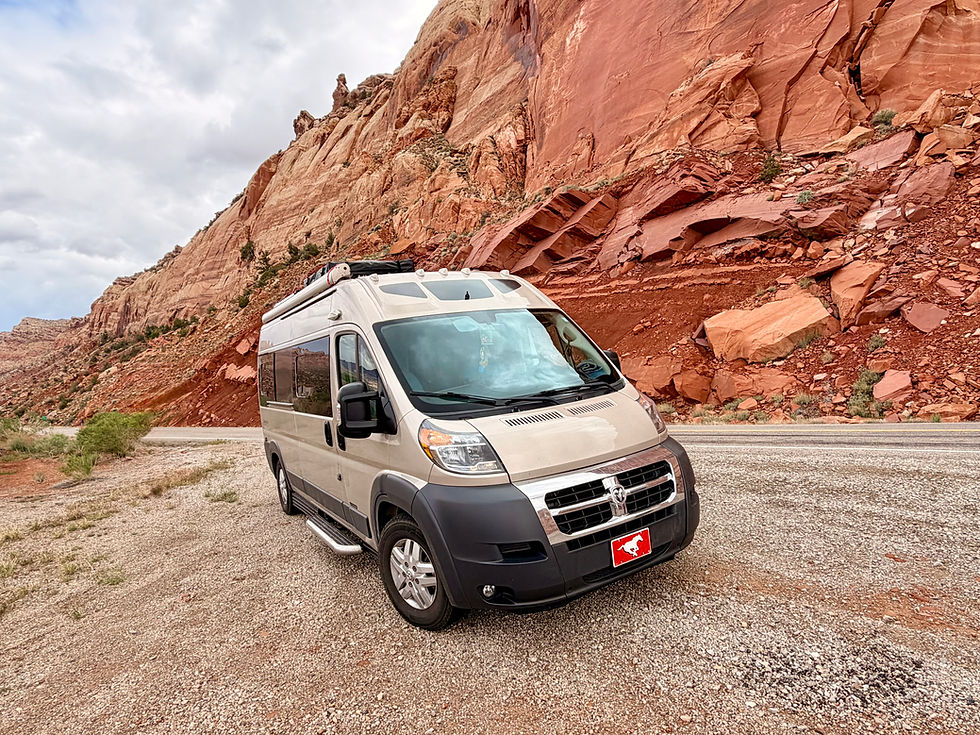


Comments